Wilderland
North Cascades — Park Atlas
North Cascades — Park Atlas
Couldn't load pickup availability
North Cascades also drawn as Park ElevationPark SilhouettesNational Parks
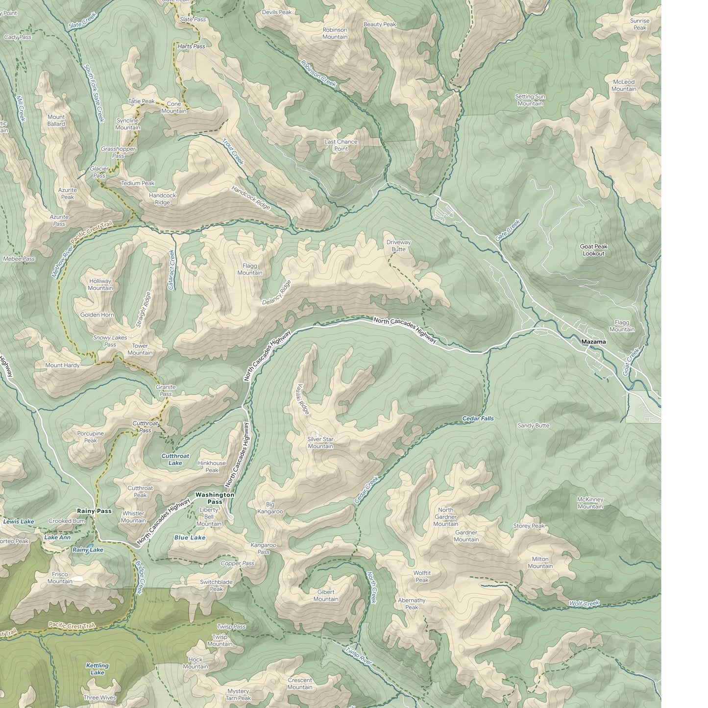
North Cascades, drawn as a full reference atlas of North Cascades National Park, Washington.
Not a simplified shape — the real map. Every named peak, pass, lookout, glacier, lake and river, the wilderness areas and park boundary, and the trail network including the long-distance routes that cross it. Close enough to plan a trip from, quiet enough to live on a wall.
- Giclee print on enhanced matte fine-art paper (200gsm), archival pigment inks
- Drawn from USGS 3DEP terrain, NHD water, GNIS names and OpenStreetMap trails
- Shaded relief built from the elevation data itself, not a stock basemap
- Full bleed inside a thin white margin, titled bottom left
SIZES
- 18 x 12 in
- 24 x 16 in
- 30 x 20 in
- 36 x 24 in
Printed on demand by our professional print partner and shipped from the facility nearest you (US & UK production). Ships rolled in a sturdy tube.
The data behind this print
- Place
- North Cascades
- Region
- North Cascades
- Series
- Park Atlas
- Source
- USGS 3DEP terrain / USGS NHD water / USGS GNIS place names / OpenStreetMap trails and roads / NPS and USFS boundaries
Terrain: USGS 3DEP. Water: USGS NHD. Names: USGS GNIS. Trails and roads: OpenStreetMap contributors. Boundaries: US National Park Service, US Forest Service.
Size guide
Size guide
| Inches | Centimetres |
|---|---|
| 18 × 12 in | 46 × 30 cm |
| 24 × 16 in | 61 × 41 cm |
| 30 × 20 in | 76 × 51 cm |
| 36 × 24 in | 91 × 61 cm |
Printed on 200gsm enhanced matte fine-art paper with archival pigment inks, and shipped rolled in a tube. Sizes are the paper, not the image — each print carries a border. Frames aren’t included.
Share